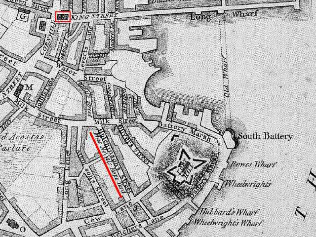
This 1777 map of Boston shows the
location of the Boston Massacre on King Street, now State Street
(see the red rectangle around the Old State House).
Also shown are the nearby ropewalks
where several incidents between ropemakers and British soldiers
precipitated the Boston Massacre (see red line under Mac Neals
Rope Yard). Note that the ropewalks must have been sold between
1770 and 1777, because the owner in 1770 was John Gray, not Mac
Neal.